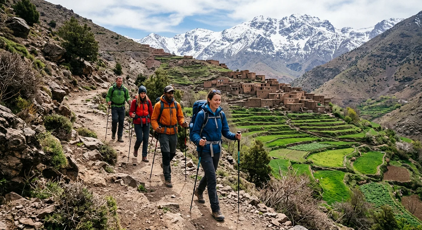
Every desert tour from Marrakech crosses the High Atlas, and many travellers add a day or two in the mountains to break the journey south. The range rises to 4,167 metres at Jbel Toubkal, North Africa's highest peak — and whether you want a half-day walk from Imlil or a full summit, it pairs beautifully with the dunes beyond.
In this guide
When to trek the Atlas on the way to the desert
April to June and September to October are the prime High Atlas trekking windows, and they overlap neatly with the cooler shoulders of desert season — handy if you want to combine the two. Mountain temperatures are comfortable, the upper snow has cleared, and the valleys are green. July and August are hot and busy on the lower trails; snow and ice can linger on Toubkal's summit into May, when crampons are still needed.
Winter trekking (December–February) is spectacular if you have the equipment and experience — Toubkal under snow is genuinely beautiful — but requires an ice axe, crampons and a guide with mountaineering experience. Several guiding companies offer guided winter ascents. Spring melt (late February to March) makes some paths muddy and stream crossings wet.
Jbel Toubkal — summit route and difficulty
Toubkal (4,167 m) is the standard summit target and is achievable by fit, acclimatised hikers without technical climbing experience — but it demands respect. The standard two-day route begins in Imlil village (1,740 m), climbs to the Toubkal Refuge (3,207 m) on day one (3–4 hours), and continues to the summit on day two (3–4 hours up, 2–3 hours down). The terrain above the refuge is rocky scree with no path marking; a guide is legally required and practically essential.
Altitude is the main challenge. Many visitors coming from sea level find the altitude uncomfortable above 3,500 m — headaches, breathlessness and fatigue are common. Ascending slowly, spending a night at the refuge to acclimatise, and being willing to turn back if symptoms worsen are the principles. Heart and respiratory conditions should be assessed by a doctor before attempting the summit.
- Physical level required: good fitness, comfortable with 5–7 hours of walking per day over rough terrain.
- Best months for summit: May–October (snow-free); crampons and ice axe needed November–April.
- Hiring a guide and mule: compulsory for the Toubkal summit; mules carry packs to the refuge and free you for the summit push.
- Altitude above the refuge (3,207 m–4,167 m): rocky, steep scree; no technical climbing but demanding.
Multi-day treks from Imlil
Imlil is the main gateway village and a 90-minute drive from Marrakech. Beyond the Toubkal ascent, the Atlas offers excellent multi-day traverse routes that visit Berber villages, walnut groves and hidden valleys. The classic 3-day route links Imlil, Tacheddirt and Amsouzart, or you can cross the Tizi n'Ouanoums pass into the Azzaden Valley for a wilder, less-visited circuit. These village-to-village treks use local gîtes (simple mountain lodges) for accommodation — basic but warm, with a communal dinner cooked over a wood fire.
A 5-day circuit can combine Toubkal's summit with the village traverse, returning via different valleys. Custom routes are readily arranged by the licensed guide associations based in Imlil; the Mountain Guides Association office is at the village trailhead. Guides typically charge MAD 500–800 per day (approximately US$50–80), plus mule hire for packs.
Day hikes from Imlil
Not every Atlas visit needs to be an overnight expedition. From Imlil, several excellent half- and full-day walks require no specialist equipment or physical conditioning beyond a reasonable level of fitness. The hike up the Ait Mizane valley to the village of Sidi Chamarouch (a Berber shrine) takes around 3–4 hours return and gives a strong taste of the mountain landscape. The Tizi n'Mzik pass (2,489 m) is reachable in a long half day and offers panoramic views toward Toubkal. Most day walks can be done without a guide, though one adds context and navigation confidence significantly.
Frequently asked
How fit do you need to be to climb Toubkal?
Genuinely fit, rather than casually active. You should be comfortable walking 5–7 hours per day with elevation gain. If you can hike a full day in the hills without significant pain, you are likely physically capable — altitude rather than technical difficulty is the real limiting factor. Build up with walking and cardio for 6–8 weeks before the trip.
Do I need a guide to trek in the Atlas Mountains?
A licensed guide is legally required for the Toubkal summit and strongly recommended for multi-day routes. For well-marked day hikes in the lower valleys around Imlil, a guide is optional but adds considerable value — navigating unmarked trails, communicating with villages and providing cultural context.
Can I combine an Atlas trek with a desert tour?
Easily — Imlil is only 90 minutes from Marrakech and sits on the way south, so a day hike or an overnight in the mountains slots naturally before the kasbah road and the dunes. Many travellers walk the Atlas first, then continue over the Tizi n'Tichka pass toward Merzouga or Erg Chigaga.
What is Imlil like as a base?
Imlil is a small Berber village at 1,740 m with a cluster of guesthouses (simple to comfortable), a handful of cafés, and the licensed guides association office. It has electricity and running water but no luxury hotels — the appeal is its authenticity and the immediate access to the trails. Several riads in the surrounding villages offer a higher comfort standard.
Is trekking in the Atlas Mountains safe?
Yes, for well-prepared trekkers with appropriate guides and equipment. The main risks are altitude illness above 3,500 m, bad weather moving in rapidly above the refuge, and getting off-route on unmarked terrain. A licensed guide addresses all three. Travel insurance covering high-altitude trekking and helicopter rescue is advisable.
Planning a trip?
Let our desert team handle the details.
Tell us your dates and style and we'll send a written itinerary and a transparent quote. We confirm by email within 24 hours.
Request an itineraryKeep reading
Planning
The Best Time to Visit Morocco
If the desert is the heart of your trip, plan around the dunes first. October to April is the prime Sahara window — comfortable days in Merzouga and Erg Chigaga, brilliant stargazing and cold but magical camp nights. Spring and autumn are the all-round sweet spots for combining the dunes with the cities and the Atlas.
Itineraries
Morocco Itinerary: 14 Days — The Grand Two-Week Route
Two weeks is the dream length for a desert lover: time for two different stretches of Sahara, the full kasbah road and gorges, the imperial cities of the north and the Atlantic coast — all unhurried, with the dunes given the days they deserve rather than a single rushed night.